

Hiking in Door County
We live here and hike with our kids. This is the list we actually use: which parks need a sticker, which trails are the real days, and how to stack a week without burning it in the car.
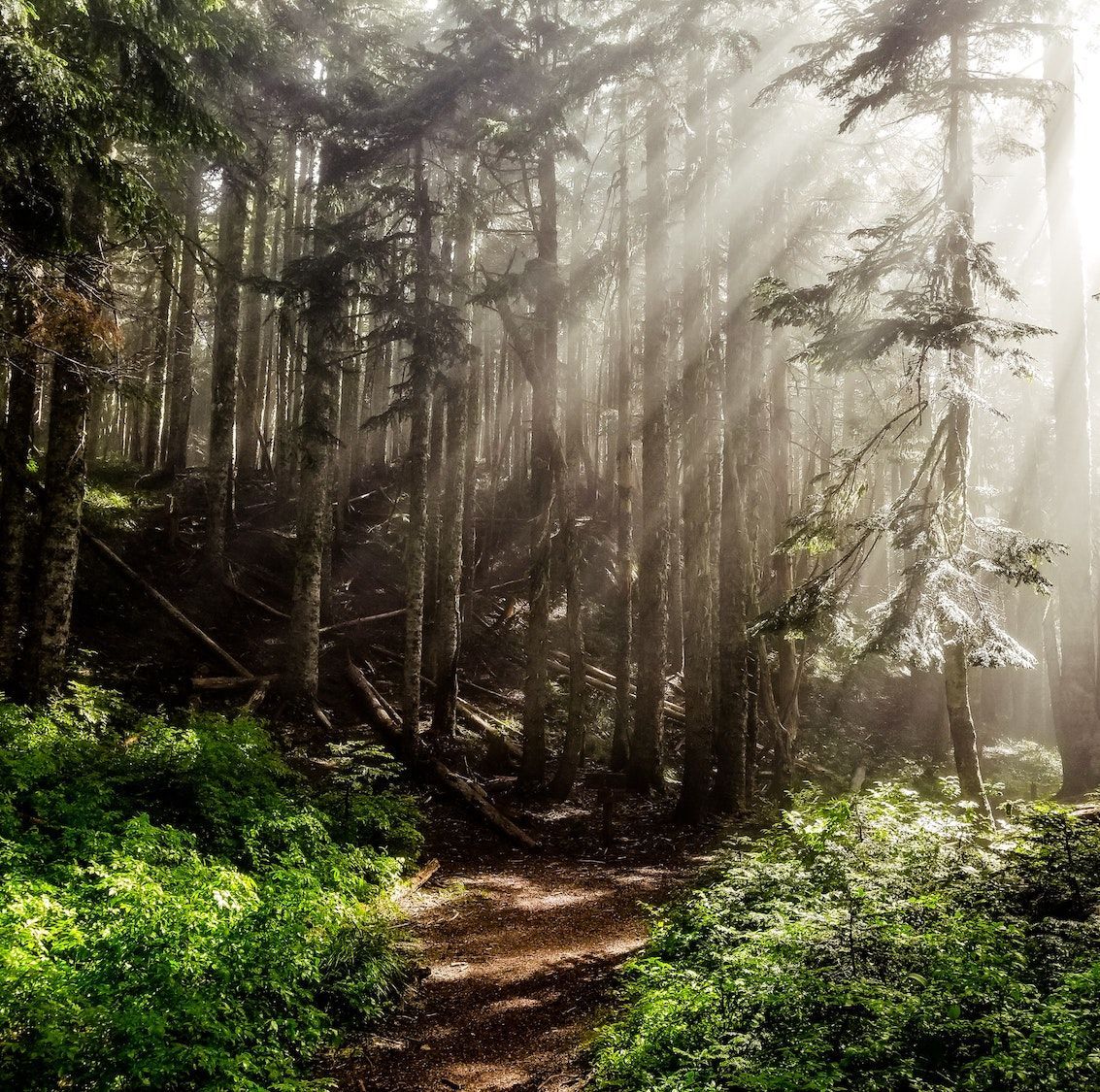
Door County hiking is shoreline and woods: bay cliffs, lake dunes, boardwalks, and quieter preserves. More marked trail than you will finish in a week.
Numbered pins match the write-ups below. Pick by where you are on the peninsula, or by the day you want. Cliffs at Peninsula, wilderness shoreline at Newport, dunes at Whitefish, boardwalks at The Ridges, Ice Age Trail at Potawatomi.
On the peninsula
Loading map…
Featured hikes Moonsail homes
Kids, strollers, easier footing
- The Ridges Hidden Brook boardwalk is wide and accessible, then the range lights. Family Discovery Trail across Hwy 57 is the kids hour (seasonal).
- Sentinel Trail at Peninsula: about two miles of packed dirt from Eagle Tower, with 0.6 mile graveled for universal access.
- Fern / Europe Bay loop at Newport: 1.2 miles, wide and flat. Not a shortened 7-miler.
- Ellison Bluff about 1.2 miles of cliff-top path. Short enough that most kids walk the whole loop.
- Brachiopod Trail at Whitefish Dunes: 1.5-mile interpretive loop. Intended accessible; some sections may need assistance.
Hiking with dogs
Most state and county parks, Fish Creek Park, and Door County Land Trust preserves allow leashed dogs. Confirm posted rules, especially in hunting season and on beaches. Leave them home for:
- The Ridges Sanctuary No dogs.
- Toft Point State Natural Area No dogs.
Newport, Ellison Bluff, Peninsula, and the Land Trust loops are the usual leash days. Mink River allows dogs (leash April 1 to August 1). Björklunden: check posted campus rules.
State park
Peninsula State Park
Bay cliffs, Eagle Tower, and the peninsula’s biggest trail network near Fish Creek.
- Difficulty Easy (Sentinel) to more difficult (Eagle)
- Miles ~20 mi of marked hiking trails
- Terrain Forest dirt, rocky bluff sections, some gravel
- Access Wisconsin state park admission required (day or annual sticker).
If you only pick one hiking day in Door County, make it Peninsula. The park sits on its own peninsula between Fish Creek and Ephraim: roughly 20 miles of marked hiking trail, eight miles of Green Bay shoreline, and the overlooks everyone photographs. From Fish Creek village you can be on trail in minutes.
Eagle Trail is the one people remember: a two-mile loop the DNR rates more difficult, rocky footing under 150-foot limestone cliffs, then a level stretch along Eagle Harbor. Pair it with Eagle Tower (wheelchair-accessible via a long ramp) when you want the wide bay view without the scramble.
Sentinel from Eagle Tower is the family loop: about two miles of packed dirt through maple, beech, and red pine, with about 0.6 mile graveled for universal access. Fall mushrooms along Sentinel if the kids will slow down. If Eagle’s lot is slammed, Skyline / Sven’s Bluff and Hemlock are the overflow.
Across Highway 42 from the park gate, Fish Creek Park is the village warm-up: roughly 150 acres after the Town of Gibraltar’s 2024 Redmann purchase, with a new crushed-gravel hike/bike path from the boat lot behind the library up the bluff behind the Settlement Shops. No state sticker. A Spring Road boardwalk has been studied; it is not an open trail yet.
Where to start
Eagle Tower / Eagle Trailheads
Peninsula State Park, Fish Creek / Ephraim, WI
Eagle Trail access at Eagle Terrace, Eagle Panorama, or Eagle Tower. Sentinel Trail starts at Eagle Tower.
Worth knowing
- Eagle Trail. Two-mile loop: cliffs, springs, and rocky footing. Wear real shoes; this is the dramatic hike people remember.
- Sentinel Trail. Easier two-mile woodland loop from Eagle Tower. Great with kids or when you want forest, not scramble. Fall mushrooms if you linger.
- Eagle Tower. Bay panorama from the rebuilt tower, with an accessible ramp route as well as stairs.
- Skyline, Sven’s, Hemlock. Overflow when Eagle Tower parking is ugly. Same park, fewer people at the trailhead.
- Fish Creek Park. Across Hwy 42 from the gate. New crushed-gravel bluff path, plan 1–3 mi. Village lot behind the library/post office (4097 Main St) or the small lot behind Settlement Shops. No sticker.
State park
Newport State Park
Wilderness-feeling Lake Michigan hiking: shoreline cutouts, boreal forest, dark skies.
- Difficulty Easy to moderate
- Miles 30+ mi of hiking trails (stack or shorten loops)
- Terrain Hardpack dirt, roots, shoreline rock and sand
- Access Wisconsin state park admission required.
Across the peninsula on the northeast tip, Newport is quieter and more remote than Peninsula’s Fish Creek gateway. Wisconsin’s only designated state wilderness park, it has over 30 miles of trail through boreal forest, meadows, and about 11 miles of Lake Michigan shoreline.
Our favorite day is the Europe Bay loop: 7 miles on old logging-road ridges, then the isthmus between Lake Michigan and Europe Lake near the north end. Pack a picnic. The park rewards a slow lunch as much as the miles.
That is not the same hike as the Fern / Europe Bay accessible loop (1.2 miles, wide and flat, interpretive signs). Use the short loop when you want an easy start with kids or mobility limits. Do not treat it as a shortened 7-miler. From Baileys Harbor, Newport is the natural hiking day.
Where to start
Newport State Park entrance
475 County Highway NP, Ellison Bay, WI
Confirm the current trail map at the park office or trailhead kiosks. Europe Bay access often via Lot 3 / Europe Bay Road.
Worth knowing
- Europe Bay loop. 7 miles. Logging-road ridges, then the isthmus between the lake and Europe Lake. Pack lunch. Often via Lot 3.
- Fern / Europe Bay accessible loop. 1.2 miles, wide and flat, interpretive signs. This is the easy start, not a shortened 7-miler.
- Lynd Point. 2.5 miles. Branches from Europe Bay and follows the rocky Lake Michigan shoreline. The scenic middle distance.
- Hotz loop. 2.3 miles along a sand ridge on Europe Lake. Rolling dunes, red pine, and lake views without the full 7-miler.
- Dark Sky Park. After a dusk hike, stay for the stars. Newport is an International Dark Sky Park.
State park
Whitefish Dunes & Cave Point
Old Baldy dune overlook, Lake Michigan beach, and wave-carved limestone ledges.
- Difficulty Easy to moderate
- Miles 14.5 mi at Whitefish + ~0.5 mi Cave Point connector
- Terrain Sand, boardwalk, forest dirt, limestone shoreline
- Access Whitefish Dunes needs a Wisconsin state park sticker. Cave Point County Park does not.
On the lake side between Jacksonport and Sturgeon Bay, Whitefish Dunes is a different Door County hike: sand, forest, and shoreline instead of bay cliffs. The DNR lists 14.5 miles of trail through dune and woods, with Old Baldy (about 93 feet above the lake, the tallest dune in the park) as the headline overlook.
Treat Cave Point County Park as part of the same day. The county park’s half-mile forest trail links into Whitefish Dunes on three sides, and the limestone ledges where waves hit the rock are the photo stop everyone knows. Rocks are slick when wet or iced; stay back from edges.
Brachiopod Trail is the 1.5-mile interpretive loop near the picnic area and shore: fossils, dunes ecology, and a Leopold bench. The DNR intends it to be accessible, but weather and terrain can make some sections harder; people using mobility aids may need assistance. Red Trail is the main Old Baldy approach (1.2 miles out and back). Yellow Trail is the longest named loop at 3.7 miles. Black Trail covers more ground toward Cave Point. Stay on marked paths and stairs: dune plants and rare shoreline habitat recover slowly if you cut corners.
Where to start
Whitefish Dunes Nature Center / Cave Point
Whitefish Dunes State Park (Clark Lake Rd) & Cave Point (Schauer Rd), WI
Start at the state park nature center for maps, or at Cave Point for the ledge overlook and connector trail.
Worth knowing
- Old Baldy. Tallest dune in the park (~93 ft above lake level) via Red Trail (1.2 mi out and back); boardwalk and stairs to the observation platform.
- Yellow Trail. 3.7 miles, the longest named loop in the park: wooded dunes, red pine plantation, and the quiet miles most people skip for Old Baldy.
- Cave Point ledges. Wave-carved limestone and underwater caves. Short walk, big scenery; combine with the state park loops.
- Brachiopod Trail. 1.5-mile interpretive loop. Intended to be accessible; some sections may need assistance. Fossils, dunes ecology, and an easy start with kids.
Nature preserve
The Ridges Sanctuary
Boardwalks through ridge-and-swale wetlands, range lights, and rare plants in Baileys Harbor.
- Difficulty Easy (boardwalks) to easy-moderate (ridge paths)
- Miles Several miles of marked sanctuary trails + boardwalks
- Terrain Boardwalk, packed path through ridges and swales
- Access Private sanctuary day pass or membership (confirm current fees at the Nature Center). Kids hike free per current Ridges policy.
The Ridges is one of our favorite places on the lake side, especially with kids. Wisconsin’s first land trust protects about 1,600 acres of ridge-and-swale landscape built by Lake Michigan’s changing shoreline: boreal forest, wetlands, orchids, and boardwalks that let you walk where the ground would otherwise be too fragile.
Start at the Cook-Albert Fuller Nature Center on Hwy 57. The first stretch on Hidden Brook Boardwalk is wide and accessible, then connects toward the Baileys Harbor Range Lights. If that is all you cover, you will not be disappointed. With more time, take the offshoot paths deeper into the ridges.
Across Hwy 57, the Family Discovery Trail is built for kids: interactive stations, forts, dirt play, the hour that is not a quiet boardwalk. Open seasonally (typically May through October); confirm hours. This is a private nonprofit sanctuary, not a state park. Day passes support trail care and research; kids hike free per current Ridges policy. Stay on boardwalks and marked trail. Late spring into early summer is when visitors hope for lady’s slippers.
Where to start
Cook-Albert Fuller Nature Center
8166 Highway 57, Baileys Harbor, WI
Visitor gateway for maps, passes, and the Hidden Brook Boardwalk. Trails generally dawn to dusk.
Worth knowing
- Hidden Brook & Range Light boardwalks. Accessible path from the Nature Center toward the historic range lights. Ideal with kids or strollers.
- Ridge-and-swale loops. Deeper trails cross boardwalks over wetlands formed by Lake Michigan’s changing shoreline.
- Family Discovery Trail. Across Hwy 57 from the main sanctuary. Interactive stations for kids. Seasonal hours; confirm before you go.
- Guided options. Self-guided or naturalist-led hikes when scheduled. Check the sanctuary calendar in season.
Nature preserve
Toft Point State Natural Area
Quiet forest walk to Moonlight Bay: rare plants, old kiln, and a Baileys Harbor classic.
- Difficulty Easy (rocky and wet near the shore)
- Miles ~2 mi out-and-back
- Terrain Forest dirt, roots; rocky/wet cobble near Moonlight Bay
- Access Free public hiking. No state park sticker. Strict leave-no-trace rules; dogs not allowed.
Just past The Ridges on Ridges Road, Toft Point is the quiet walk when you want solitude without driving to Newport. The main trail runs roughly a mile through maple, hemlock, and boreal woods to the rocky dolomite shoreline on Moonlight Bay, about two miles round trip.
This is a State Natural Area managed by UW-Green Bay (about 743 acres; the DNR SNA listing is 732): National Natural Landmark, Ramsar wetland recognition, orchids, warblers, and a shoreline that feels farther from town than it is. Along the way you pass remnants of the old Toft resort cottages and one of Wisconsin’s best-preserved early circular lime kilns.
Treat it gently. Parking is tiny; if the lot is full, come back later or carpool from Baileys Harbor Ridges County Park or Town Hall. No dogs, no bikes, no camping or picnicking, and stay on the trail. The shore end gets rocky and wet; wear real shoes.
Where to start
Toft Point trailhead
1982 Ridges Road, Baileys Harbor, WI
From The Ridges Nature Center, continue east on Ridges Road ~1.4 miles; entrance on the left. Overflow: carpool from 2301 Ridges Rd or Baileys Harbor Town Hall.
Worth knowing
- Moonlight Bay shoreline. Wave-cut dolomite and cobble beach at the end of the trail. Slippery when wet; give the rare shoreline plants space.
- Lime kiln & resort remnants. Historic circular kiln plus cottage/barn structures maintained by Friends of Toft Point along the walk.
- Pair with The Ridges. Same road corridor as the sanctuary. Ridges for boardwalks and orchids; Toft Point for a quieter bay-side out-and-back.
Private campus
Björklunden
Quieter Lake Michigan shoreline and woods trails most visitors never hear about.
- Difficulty Easy
- Miles ~3 mi of public campus trails
- Terrain Dirt path, shoreline, woods and meadow
- Access Private campus trails open for respectful public walking. Confirm any posted rules before you go.
Unless you are staying at the Björklunden retreat center (Lawrence University), you might not hear about these trails. That is part of the appeal: secluded shoreline and mixed woods when Peninsula feels busy.
Lawrence describes about three miles of publicly accessible trail on the 441-acre north campus, including Lake Trail, Quarry Trail, and Turbine Pass. The shoreline stretch along Lake Michigan is the highlight; stack the inland loops if you want a longer easy walk.
Main campus address is 7590 Boynton Lane, just south of Baileys Harbor. Public walking on marked trails is welcomed; this is still a private campus and retreat landscape, not a state park. Stay on marked trail, keep groups small, and follow any posted access notes.
Where to start
Björklunden campus
7590 Boynton Lane, Baileys Harbor, WI
Look for marked trail access near the lodge / campus core. Stay on signed paths; do not wander into private program areas.
Worth knowing
- Lake Trail shoreline. The Lake Michigan edge of campus: easy walking with the best water views.
- Quarry Trail & Turbine Pass. Inland connectors through woods and meadow that let you loop without retracing the shore.
- Low crowds. Best when you want solitude more than park amenities or long stacked state-park miles.
County park
Ellison Bluff County Park
One short cliff-top trail, huge Green Bay views, and a classic sunset stop.
- Difficulty Easy
- Miles ~1.2 mi main trail
- Terrain Cliff-top path, stairs to observation deck
- Access Door County park; no state park sticker required.
We love Ellison Bluff less for a big trail system (there is essentially one main walk) and more for the setting. The park sits on the Niagara Escarpment: a path along the top of 100-plus-foot cliffs with westerly views over Green Bay.
A short stairway leads to an observation deck. The full loop is about 1.2 miles, which makes it perfect with kids, for birding, or as a sunset stop before dinner farther north (Wickman House in Ellison Bay is our usual pairing).
No state park sticker here; it is a Door County park. Bring a light layer. The bluff can feel windier than the woods even on warm days.
Where to start
Ellison Bluff County Park
Ellison Bluff Road, Ellison Bay, WI
Small park with the bluff trail and observation deck. Arrive early for sunset parking on busy summer weekends.
Worth knowing
- Observation deck. West-facing bay views; our favorite simple sunset hike on the peninsula.
- Kid-friendly length. Short enough that most kids can walk the whole loop themselves.
State park
Potawatomi State Park
Southern Door forest and bluff, and the eastern end of the Ice Age Trail.
- Difficulty Easy to moderate
- Miles ~6 mi of hiking trails (stack or shorten loops)
- Terrain Forest dirt, bluff, Green Bay shoreline
- Access Wisconsin state park admission required (day or annual sticker).
Southwest of Sturgeon Bay, Potawatomi is southern Door’s trail park: 1,178 acres of woods and Green Bay shoreline, about six miles of hiking, and usually fewer people than Peninsula on a July Saturday.
This is the eastern terminus of the Ice Age National Scenic Trail. The marker sits near the old ski hill overlook. Walk the park’s 2.8-mile Ice Age segment, or just stand at the start of a thousand miles. Either way, it is the fact that makes this more than “the other state park.”
Tower Trail is the 3.6-mile loop to the old observation tower site on the highest bluff in the park. Hemlock (2.6 miles) starts at Picnic Lot 2 and works the shoreline and campground woods. Ancient Shores is the 0.5-mile interpretive loop from the Nature Center: three ancient lake levels, easy with kids. State sticker at the gate.
Where to start
Old ski hill overlook / Ice Age Trail eastern terminus
Potawatomi State Park, 3740 County PD, Sturgeon Bay, WI
Tower Trail and the Ice Age terminus share parking at the old ski hill overlook. Ancient Shores starts at the Nature Center. Hemlock starts at Picnic Lot 2.
Worth knowing
- Ice Age Trail eastern terminus. The 1,000-mile National Scenic Trail ends (or starts) here. The park segment is 2.8 miles; the marker is at the old ski hill overlook.
- Tower Trail. 3.6-mile loop to the old tower site on the highest bluff. The full-park walk most people come for.
- Hemlock Trail. 2.6 miles from Picnic Lot 2: Green Bay shoreline, campground edge, and interior woods.
- Ancient Shores. 0.5-mile interpretive loop from the Nature Center. Easy start with kids; three ancient lake levels.
Door County Land Trust preserves
Fifteen nature preserves, open dawn to dusk at no charge. Short loops through escarpment, wetlands, and shoreline most visitors never find. Grab their free printed hiking map if you want every trailhead in one place.
Bay Shore Blufflands Nature Preserve
Niagara Escarpment views over Green Bay; lower + upper loops through fields and forest.
Preserve page →Kangaroo Lake Nature Preserve
DCLT’s first preserve. Escarpment down to Kangaroo Lake / Peil Creek boreal shore.
Preserve page →Harold C. Wilson Three Springs Nature Preserve
Largest DCLT preserve. Springs overlook, historic farmstead, Hine’s emerald dragonfly habitat.
Preserve page →Sturgeon Bay Ship Canal Nature Preserve
Ridge-swale + dune plants inside city limits; major migratory bird stopover.
Preserve page →Oak Road Nature Preserve
Vernal wetland + farmland-to-oak/prairie restoration; spring peepers famous.
Preserve page →White Cliff Nature Preserve
Alkaline fen + mature forest + escarpment talus near downtown Egg Harbor.
Preserve page →Lautenbach Woods Nature Preserve
Dolomite fractures, vernal pond, rare land snails; newer grassland trail segment.
Preserve page →Legacy Preserve at Clay Banks
~3,000 ft undeveloped Lake Michigan shore; clay bluffs + grassland birds.
Preserve page →Heins Creek Nature Preserve
Glacial meltwater creek through old-growth forest. Short peaceful loop.
Preserve page →Bear Creek Nature Preserve
Newest preserve (2024+). 50-ft glacial riverbanks; trails/boardwalks still maturing.
Preserve page →Ephraim Nature Preserve at Anderson Pond
Wetlands, hemlock, cobble beach ridge, escarpment edge woven through village history.
Preserve page →Detroit Harbor Nature Preserve
Old-growth forest + shoreline habitat on the island.
Preserve page →Domer-Neff Nature Preserve and Bird Sanctuary
Bird sanctuary (200+ species recorded); connects toward Stavkirke meditation trail.
Preserve page →Little Lake Nature Preserve
N half of island’s only inland lake; cobble ridge, spring-fed water.
Preserve page →Richter Community Forest Nature Preserve
Large never-clear-cut forest tract; tip-up mounds, spring wildflowers, bedrock ridges.
Preserve page →
Crossroads & Nature Conservancy
Sturgeon Bay’s in-town preserve plus three TNC walking landscapes: Mink River near Ellison Bay, then Mud Lake and Shivering Sands on the lake-side wetland corridor.
Crossroads at Big Creek
Free urban-edge preserve: Field/Forest/Meadow/Creek trails, learning center. Dogs on leash (not at Cove).
Learn more →Mink River Estuary (TNC)
Freshwater estuary. Bluff, Cedar, Schoenbrunn, Fern, and Maple Ridge trails. Fern is often too wet in spring/summer. Dogs allowed (leash Apr 1–Aug 1). Bugs and wet ground in season.
Learn more →North Bay–Mud Lake Preserve (TNC)
Level corridor through rare wetland/forest complex; partners with Ridges + DCLT landscape.
Learn more →Shivering Sands Preserve (TNC)
Wetland/dune complex; Hine’s emerald dragonfly habitat. Bugs in early summer.
Learn more →
Also great if you want more miles
A ferry-only island day (Rock Island plus Jackson Harbor Ridges), rustic county headlands, and the long limestone path when you want easy flat miles.
Rock Island State Park
Ferry to Washington Island, then the Karfi to Rock Island: ~10 mi of trail, no cars or bikes, Pottawatomie Lighthouse. Seasonal ferry logistics only.
Learn more →Jackson Harbor Ridges
Washington Island State Natural Area: beach, dune, and ridge-and-swale walking at Jackson Harbor. Pair with Rock Island or the island Land Trust preserves. Fragile plants; stay on the path.
Learn more →Door Bluff Headlands
Rustic county park north of Ellison Bay with mostly unmarked trails and Death’s Door / Hedgehog Harbor bluff views. Few amenities; bring a map sense.
Learn more →Ahnapee State Trail
Long crushed-limestone multi-use corridor through southern Door (and beyond). Better as a flat walk or gravel ride than a “trail day,” but excellent for easy miles. Overlaps the Ice Age Trail in places.
Learn more →Meridian County Park
Hwy 57 wayside between Jacksonport and Baileys Harbor with unmarked rustic trails into ridge-and-dune woods (and toward Lyle-Harter-Matter Sanctuary).
Learn more →Horseshoe Island
Not a trailhead hike. Kayak or boat from Nicolet Bay in Peninsula State Park for a short rustic island circuit. Weather and water skills required.
Learn more →
Practical notes
- State parks need a Wisconsin vehicle sticker (day or annual). Buy at the gate or online before you roll up on a busy Saturday. Fish Creek Park, most county parks, and Door County Land Trust preserves do not charge that sticker.
- Fish Creek Park’s bluff path is new and still evolving after the Redmann expansion. The Spring Road wetland boardwalk idea is not an open trail yet; stick to the signed crushed-gravel route.
- The Ridges is a private sanctuary. Budget for a day pass or membership, stay on boardwalks and marked trail, and leave pets at home unless their current policy says otherwise.
- Toft Point is free and open for hiking, but fragile: no dogs, no bikes, tiny parking lot, stay on the trail. If the lot is full, come back later rather than inventing a roadside spot.
- Björklunden is Lawrence University’s private campus. Public walking on marked trails is welcomed; treat it like a quiet campus, not a state park playground.
- Door County Land Trust’s 15 nature preserves are free, open dawn to dusk, and built for low-impact walking. Conservation easements on private land are not open to the public.
- Eagle Trail, Cave Point ledges, and other rocky shoreline or bluff hikes want real footwear. Sandals are fine for boardwalks; they are a bad idea on limestone.
- Bugs are real from late spring through midsummer, especially in wetlands (Ridges, Mink River, Mud Lake, Shivering Sands, Oak Road). Pack spray with the water bottles.
- During hunting seasons in and around parks and preserves, wear high-visibility clothing and know what is open that day.
- Winter hiking and snowshoeing are excellent when trails are packed. Newport, Peninsula, The Ridges, and many Land Trust preserves work in cold months; check conditions first.
- Leave dunes, orchids, and wet soils alone. Door County’s fragile shoreline habitats do not bounce back from shortcutting.
Prefer two wheels? See our Door County mountain biking guide, pair a hike day with the state parks overview, or base yourself in Fish Creek or Baileys Harbor depending on which trails you care about most.